
Elaho River Restoration Project in Partnership with Squamish Nation
Funding support:
Healthy Waters Initiative, BC Salmon Restoration and Innovation Fund
West Coast Energy Fund, Pacific Salmon Foundation,
Community Salmon Program
Project Background
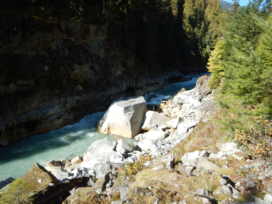
Historically, the upper Elaho River was utilized by Squamish Nation as a location to fish, particularly for Chinook salmon. Mobile summer camps were established annually by the Clendinning River. However, with the construction of the logging road in the early 1970's large boulders from the road blasting fell into the river creating an anadromous barrier. Anecdotal sightings of Chinook had been observed in the ensuing years (S. Rochetta, pers. comm., R. Lewis, pers. comm.).
Site Location
The Elaho River (Watershed Code 900-097600-70400; FISS map #92J03; UTM 10 472269E 5550891N) has a length of 65 km and a watershed drainage area of 1,250 m2.
- Located 52 km upstream of the confluence of the Squamish River into Howe Sound.
- Two major tributary systems, Sims Creek and Clendinning Creek, discharge into the Elaho River.
- The watershed is within the traditional territory of the Squamish Nation and encompasses three Wild Spirit Places “Nsiiyx-nitem tl’a sutch (Upper Elaho), Nexw-àyantsut (Sims Creek) and Esté-tiwilh (West Squamish).
- Clendinning Provincial Park and Upper Elaho Valley Conservancy are also within the watershed.
Objectives
From 2017 to the present (Autumn 2021) this project is being lead by Squamish Nation and Fisheries and Oceans Canada to restore anadromous access for migratory Chinook salmon to the upper watershed above large rock barriers. From 2017 to 2019 the upper house size obstruction was blasted and from 2020 to the present, downstream the next anadromous rock barrier is being blasted down to create fish-friendly access.
Accomplishments to date:
Accomplishments to date:
- On-site consultation and meetings with Squamish Nation, Fisheries and Oceans Canada, and Provincial staff
- Baseline survey of triver obstructions (1, 2, & 3) including elevations, stream gradient, and extent of the obstructions.
- Development of plans to blast the rock obstruction or create an anadromous passage.
- Conduct aerial drone videography of the site prior to blasting to establish a video baseline.
- Monitor upstream and downstream of the obstruction for fish presence, water quality, e-DNA sampling and summarize the results of the fish monitoring.
- Hiring of Global Rock Access to blast obstructions
- Follow-up monitoring
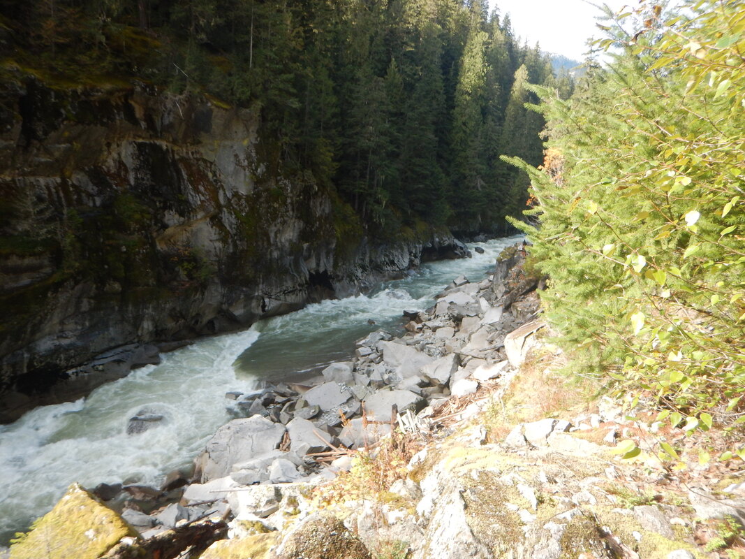
Blasting of Obstruction #1 (Upper Barrier)
|
November 2017: The first year was spent working on the removal of the smaller rock to the side of the massive boulder. This was accomplished by surveying the site, meeting with the rock blasting company, Global Rock Works, and setting up the explosives to reduce the size of this smaller rock.
|
October 2018:
|
|
|
|
|
|
|
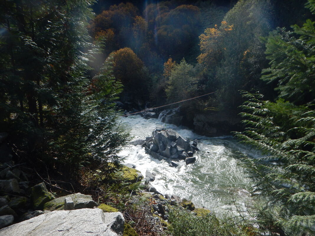
October 2017 - Pre-blast; on-site meeting
|
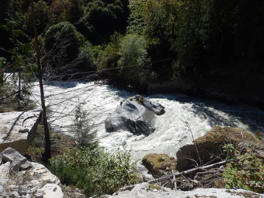
October 2021 - post blast; anadromous access restored
|
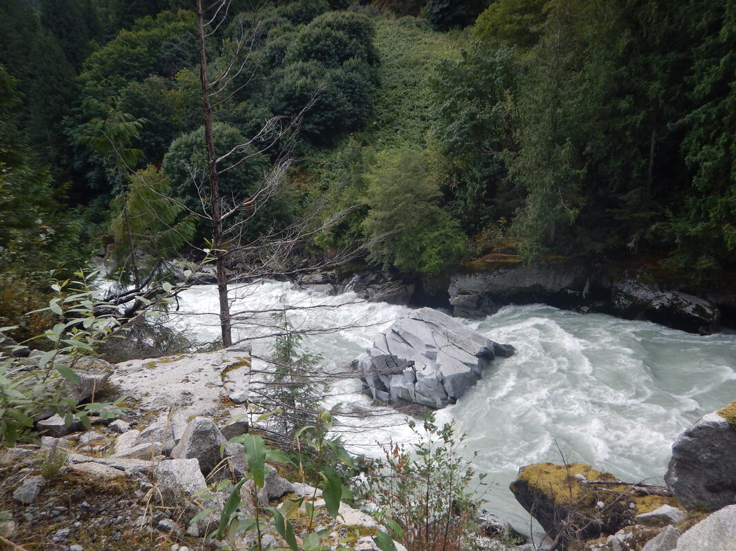
Obstruction #2 Blast Work: October 2020 to October 2021
October 2020 - setting up to begin blasting
|
November2020 - blast work completed
|
October 2021 - placement of air-bags to shift rock downstream
|
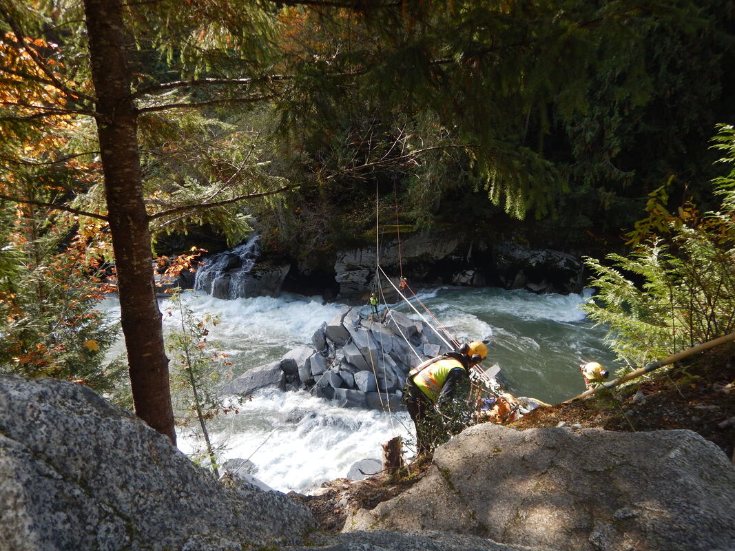
October 2021 - crews moving onto site
|
GIS Mapping and Videography
GIS mapping of the site was conducted and aerial drone videography by Coastal Photo Studios was collected. Observe the results below.
|
November 2017:
|
September 2018:
|
|
|
|
|
|
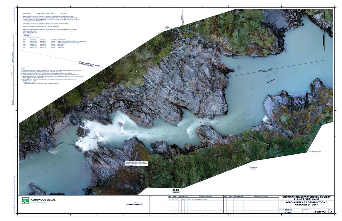
Survey of lower obstruction |